
Exploring the Benefits of Geophysical Surveys
- J. Scott Horn
- Nov 5, 2025
- 4 min read
Geophysical analysis methods have become essential tools in various fields such as environmental studies, engineering, archaeology, and natural resource exploration. These techniques allow experts to investigate the subsurface without the need for invasive digging or drilling. By using advanced technology, geophysical analysis methods provide valuable data that can save time, reduce costs, and minimize environmental impact.
Understanding Different Geophysical Analysis Methods
There are several geophysical analysis methods, each designed to detect specific subsurface features. Some of the most common techniques include:
Seismic Methods: These involve sending shock waves into the ground and measuring their reflections to map underground structures. They are widely used in oil and gas exploration.
Magnetic Methods: These detect variations in the Earth's magnetic field caused by different rock types or buried objects.
Electrical Resistivity: This method measures how strongly the ground resists electrical current, helping to identify water content, soil types, and buried materials.
Ground Penetrating Radar (GPR): GPR uses radar pulses to image the subsurface, useful for locating utilities, voids, and archaeological artifacts.
Gravity Surveys: These measure variations in the Earth's gravitational field to detect density differences underground.
Each method has its strengths and limitations, and often, a combination of techniques is used to get a comprehensive understanding of the subsurface.
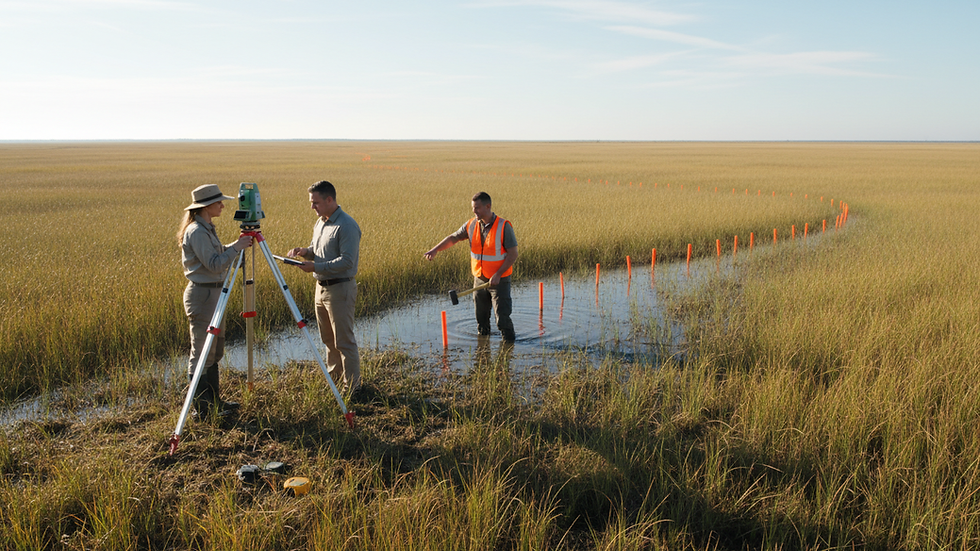
What is a geophysical survey?
A geophysical survey is a non-invasive investigation technique that collects data about the physical properties of the Earth's subsurface. It involves using specialized instruments to measure natural or induced physical fields such as magnetic, electrical, seismic, or gravitational fields. The data collected helps create detailed maps and models of underground features without excavation.
For example, in construction projects, a geophysical survey can identify underground utilities or unstable soil layers before building begins. In archaeology, it can reveal buried structures or artifacts without disturbing the site. This approach not only saves time and money but also protects sensitive environments.

Practical Applications and Benefits of Geophysical Analysis Methods
The benefits of geophysical analysis methods extend across many industries. Here are some practical applications and their advantages:
Environmental Assessment
Geophysical methods help detect contamination plumes, groundwater flow, and soil conditions. This information is crucial for environmental remediation and monitoring.
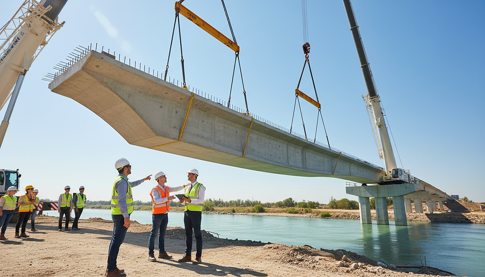
Engineering and Construction
Before construction, geophysical surveys identify subsurface hazards such as voids, sinkholes, or unstable soils. This reduces the risk of structural failure and costly delays.
Natural Resource Exploration
Mining and oil companies use these methods to locate mineral deposits, oil reservoirs, and groundwater. This targeted approach improves extraction efficiency and reduces environmental impact.
Archaeology
Non-invasive surveys allow archaeologists to locate and map buried artifacts and structures, preserving the site’s integrity.
Agriculture
Soil mapping through geophysical methods helps optimize irrigation, fertilization, and crop management, leading to better yields and sustainable practices.
The use of these methods leads to cost savings, improved safety, and environmental protection. They provide detailed subsurface information that would otherwise require extensive and disruptive excavation.
How to Choose the Right Geophysical Analysis Method
Selecting the appropriate geophysical analysis method depends on several factors:
Project Goals: Define what you want to find or understand about the subsurface.
Site Conditions: Consider soil type, terrain, and accessibility.
Depth of Investigation: Different methods have varying penetration depths.
Budget and Time Constraints: Some techniques are more expensive or time-consuming than others.
Data Resolution Needs: Higher resolution may require more advanced or combined methods.
For example, if the goal is to locate buried utilities in an urban area, Ground Penetrating Radar might be the best choice due to its high resolution and shallow penetration. For deep mineral exploration, seismic or gravity surveys may be more appropriate.
Consulting with geophysical experts can help tailor the survey design to meet specific project requirements effectively.

Future Trends in Geophysical Analysis Methods
The field of geophysical analysis is continuously evolving with technological advancements. Some emerging trends include:
Integration with GIS and Remote Sensing: Combining geophysical data with geographic information systems (GIS) and satellite imagery enhances spatial analysis and decision-making.
Automation and AI: Machine learning algorithms are being developed to interpret complex geophysical data faster and more accurately.
Portable and Real-Time Equipment: Advances in sensor technology allow for more mobile and real-time data collection, improving field efficiency.
Environmental Sustainability: New methods focus on minimizing environmental disturbance and energy consumption during surveys.
These innovations will expand the applications and improve the accuracy and efficiency of geophysical analysis methods, making them even more valuable for future projects.
Maximizing the Impact of Geophysical Analysis Methods
To get the most out of geophysical analysis methods, consider the following recommendations:
Plan Thoroughly: Define clear objectives and understand site conditions before selecting methods.
Use Multiple Techniques: Combining methods often provides a more complete picture of the subsurface.
Invest in Quality Equipment and Expertise: Reliable instruments and skilled operators ensure accurate data collection.
Interpret Data Carefully: Collaborate with geophysicists and other specialists to analyze results correctly.
Apply Findings Practically: Use survey results to guide project decisions, reduce risks, and optimize resources.
By following these steps, organizations can leverage geophysical analysis methods to enhance project outcomes and achieve sustainable success.
Geophysical analysis methods offer powerful tools for exploring and understanding the subsurface in a non-invasive, cost-effective way. Whether for environmental protection, construction safety, resource exploration, or archaeological preservation, these techniques provide critical insights that drive informed decisions. Embracing the latest technologies and best practices will ensure continued benefits and innovation in this dynamic field.

Comments